Property Record
3605 Holcomb Bridge Rd, Peachtree Corners, GA 30092
NEARBY LISTINGS FOR SALE OR LEASE
-
-
View all Peachtree Corners listings for sale on LoopNet.com
Property Detail
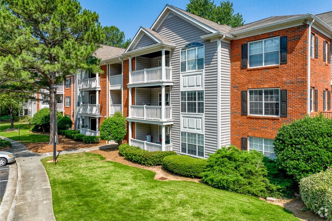
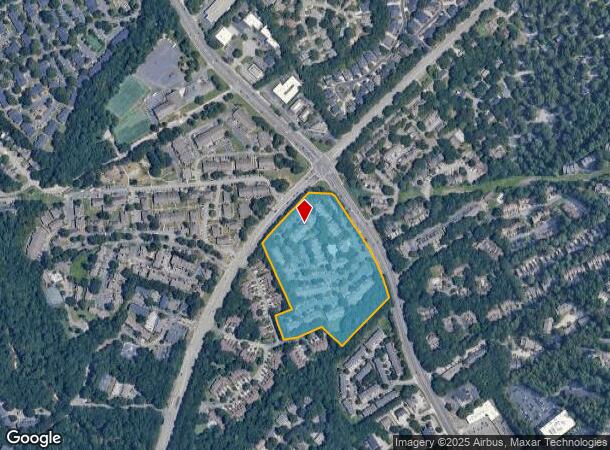
3605 Holcomb Bridge Rd
Atlanta-Sandy Springs-Roswell, GA
Holcomb
6-283-016B
HOLCOMB BR RD
Apartment
Gwinnett
AE
Georgia
13135C0081G
282
2025
11.73 AC
2025
Peachtree Corners
050336
Atlanta
174,365 SF
DEMOGRAPHICS near 3605 Holcomb Bridge Rd
1 Mile
3 Mile
5 Mile
2024 Total Population
14,909
74,770
217,189
2029 Population
15,431
76,892
221,622
Pop Growth 2024-2029
+ 3.50%
+ 2.84%
+ 2.04%
Average Age
36
38
38
2024 Total Households
6,693
28,864
81,029
HH Growth 2024-2029
+ 3.56%
+ 2.84%
+ 1.97%
Median Household Inc
$51,626
$74,337
$74,568
Avg Household Size
2.20
2.50
2.60
2024 Avg HH Vehicles
2.00
2.00
2.00
Median Home Value
$337,780
$446,126
$437,031
Median Year Built
1984
1986
1986
Nearby Places
Map Layers
Map Styles
 Street
 Aerial
- Restaurants
- Banks
- Shops
- Fitness
- Groceries
PUBLIC TRANSPORTATION
AIRPORT
Hartsfield - Jackson Atlanta International
DRIVE
WALK
Distance
Hartsfield - Jackson Atlanta International
44 min
30.9 mi
Freight Ports
Georgia Ports - Savannah
DRIVE
WALK
Distance
Georgia Ports - Savannah
299 min
265.3 mi
Nearby Properties
Address
Land Use
TOTAL SIZE
Lot Size
Zoning
Address
Land Use
TOTAL SIZE
Lot Size
Zoning
599,105 SF
9.13 AC
M1
Address
Land Use
TOTAL SIZE
Lot Size
Zoning
524,000 SF
44.93 AC
RM
Address
Land Use
TOTAL SIZE
Lot Size
Zoning
545,074 SF
53.40 AC
RM8
Address
Land Use
TOTAL SIZE
Lot Size
Zoning
286,481 SF
20.06 AC
M1
Address
Land Use
TOTAL SIZE
Lot Size
Zoning
358,622 SF
31.01 AC
RM13
Address
Land Use
TOTAL SIZE
Lot Size
Zoning
231,192 SF
12.88 AC
RM13
Address
Land Use
TOTAL SIZE
Lot Size
Zoning
303,866 SF
20.13 AC
RM
Address
Land Use
TOTAL SIZE
Lot Size
Zoning
424,948 SF
39.03 AC
RM13
Address
Land Use
TOTAL SIZE
Lot Size
Zoning
1,423,656 SF
15.44 AC
OI
Address
Land Use
TOTAL SIZE
Lot Size
Zoning
426,839 SF
37.47 AC
MUD
Address
Land Use
TOTAL SIZE
Lot Size
Zoning
250,886 SF
22.93 AC
RM13
Address
Land Use
TOTAL SIZE
Lot Size
Zoning
483,279 SF
8.27 AC
BH
Address
Land Use
TOTAL SIZE
Lot Size
Zoning
475,389 SF
5.37 AC
NX
Address
Land Use
TOTAL SIZE
Lot Size
Zoning
297,057 SF
25 AC
X
Address
Land Use
TOTAL SIZE
Lot Size
Zoning
249,766 SF
25.34 AC
RM100
Address
Land Use
TOTAL SIZE
Lot Size
Zoning
220,150 SF
21.08 AC
RM13
Address
Land Use
TOTAL SIZE
Lot Size
Zoning
459,745 SF
50.72 AC
RM10
Address
Land Use
TOTAL SIZE
Lot Size
Zoning
420,576 SF
27.06 AC
M2
Address
Land Use
TOTAL SIZE
Lot Size
Zoning
255,398 SF
12.45 AC
MUR
Address
Land Use
TOTAL SIZE
Lot Size
Zoning
291,110 SF
22.10 AC
X
Address
Land Use
TOTAL SIZE
Lot Size
Zoning
454,220 SF
30 AC
M1
Address
Land Use
TOTAL SIZE
Lot Size
Zoning
220,915 SF
2.38 AC
HX
Address
Land Use
TOTAL SIZE
Lot Size
Zoning
390,776 SF
43.96 AC
RM8
Address
Land Use
TOTAL SIZE
Lot Size
Zoning
225,314 SF
68.32 AC
OI
Address
Land Use
TOTAL SIZE
Lot Size
Zoning
781,705 SF
60.29 AC
M1
Address
Land Use
TOTAL SIZE
Lot Size
Zoning
205,850 SF
24.63 AC
RM10
Address
Land Use
TOTAL SIZE
Lot Size
Zoning
204,333 SF
39.43 AC
RM10
Address
Land Use
TOTAL SIZE
Lot Size
Zoning
428,933 SF
50.01 AC
PRD
Address
Land Use
TOTAL SIZE
Lot Size
Zoning
336,694 SF
32.05 AC
RM10
Address
Land Use
TOTAL SIZE
Lot Size
Zoning
228,548 SF
16.50 AC
RM10
The World's #1 Commercial Real Estate Marketplace
Connect with us
© 2026 CoStar Group
The information above has been obtained from sources believed reliable. While we do not doubt its accuracy we have not verified it and make no guarantee, warranty or representation about it. It is your responsibility to independently confirm its accuracy and completeness. Any projections, opinions, assumptions, or estimates used are for example only and do not represent the current or future performance of the property. The value of this transaction to you depends on tax and other factors which should be evaluated by your tax, financial, and legal advisors. You and your advisors should conduct a careful, independent investigation of the property to determine to your satisfaction the suitability of the property for your needs.